Introduction
Mountain Sabyinyo is one of the eight volcanic mountains that make up the Virunga region that covers three countries namely; Uganda, Rwanda and Democratic Republic of Congo. Mountain Sabyinyo is as well an inactive volcano that is part of the three volcanoes in Mgahinga National Park namely Mount Muhabura and Mount Gahinga. This mountain derived its name “Sabyinyo” from its tooth looking like summit structure that is made up of five summit peaks. “Sabyinyo” is a Kinyarwanda word that means “tooth” an old man’s tooth that was referred to due to its serrated summit that resembles worn teeth in a gum line. Mount Sabyinyo’s highest peak stands at 3,669meters above sea level which marks the intersection of the borders of Uganda, the Democratic Republic of Congo and Rwanda. Mount Sabyinyo is also with in the adjoining National Parks namely Volcanoes National Park in Rwanda, Mgahinga National Park in Uganda and Virunga National Park in the Democratic Republic of Congo. Mountain Sabyinyo’s slopes are a habitat to the endangered mountain gorillas and other wildlife in the Park. Therefore there are several activities that are carried out along mount Sabyinyo’s slopes which include; gorilla trekking, birding, golden monkey trekking and hiking mount Sabyinyo.
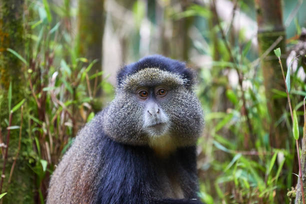
Hiking mountain Mgahinga starts with a briefing held at the Park head offices after which you set off on foot accompanied by UWA guides and rangers. You may as well decide to hire a porter to assist you carry your bag and other items at a cost. Embarking on your hike, you traverse through bamboo forested areas where you may have a chance of spotting some animals like the mountain gorillas, golden monkeys and many more. After a period of around 45minutes, the elevation starts picking up rapidly while you find your way up the twisting and looping trail encircled by trees with long, thick and unkempt several green and yellow lichens hanging from tree branches and growing in a wide range of habitats.
Proceeding with your hike, you will start getting closer to the first peak where you will encounter the ladders and stairs that you will take and thus the trail’s nickname “stairways in the mist”. The first peak stands at an elevation of 3,423meters above the sea level where you will encounter a hut for shelter in case the weather is not favorable. You may as well decide to have a snack before proceeding along a ridgeline where you will encounter more ladders and stairs to keep you firm and solid as you continue with your hike. At this point, you will start capturing spectacular views of its surroundings such as Lake Bunyonyi.
The second summit stands at 3,537 meters that you will traverse arriving at the third summit that stands at 3,669 meters which is the highest and shared by Uganda, Rwanda and Democratic Republic of Congo. At this point you are able to view all the three countries in a distance where you will as well take your summit pictures before you descend back using the same trails.
The hike to the highest peak of mountain Sabyinyo lasts for about 7 to 10 hours to and from and that’s why it is advisable to start hiking by around 8:00am. The distance covered to and from the highest peak is around 15km which confirm its intermediate difficulty level. The best time to hike Mountain Sabyinyo is during the dry season in the months of June to early September and December to February. During this period, there are less rainfall amounts received which makes the hiking trails dry and accessible compared to when they are slippery during the rain season.